Kim Eslinger
Editor
612-321-8040
kim@millcitymedia.org

Brianna Ojard
Associate Editor

David Tinjum
Publisher
612-321-8020
dave@millcitymedia.org

Claudia Kittock
Columnist / Non-Profits
Email Claudia...

Becky Fillinger
Small Business Reporter
Producer / Milling About
Email Becky...

Michael Rainville Jr.
History Columnist
Email Michael...

Doug Verdier
River Matters

Mill City Times is a not-for-profit community service. We do not sell advertising on this site.

Community Partners

Thanks to our community partners, whose support makes Mill City Times possible:

MILL CITY FARMERS MARKET

With over 100 local farmers, food makers and artists, MCFM strives to build a local, sustainable and organic food economy in a vibrant, educational marketplace.

Visit their website...

HENNEPIN HISTORY MUSEUM

Hennepin History Museum is your history, your museum. We preserve and share the diverse stories of Hennepin County, MN. Come visit!

Visit their website...

MEET MINNEAPOLIS

Maximizing the visitor experience of Minneapolis for the economic benefit of our community, making Minneapolis the destination of choice among travelers.

Visit their website...

MSP FILM SOCIETY

Promoting the art of film as a medium that fosters cross-cultural understanding, education, entertainment, and exploration.

Visit their website...

GREAT RIVER COALITION

Enhancing the Minneapolis riverfront environment—for people and pollinators.

Visit their website...

Cultural Cornerstones
Search Mill City
Recent News
Front Page Archives

Minneapolis Riverfront News

Covering life, work, and play in the Historic Mill District and Downtown Minneapolis Riverfront neighborhoods. Have an opinion, local news or events to share?  Contact us.

Entries by Kathleen Boe (7)

Thursday
Sep142017

Exploring the Upper River: Bridges

Article by Kathleen BoeMinneapolis Riverfront Partnership

Exploring the Upper River

A look at places that are hidden gems along the Minneapolis Riverfront

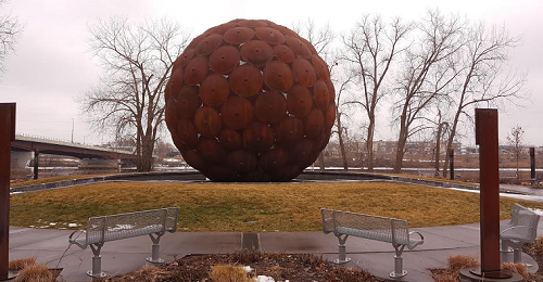
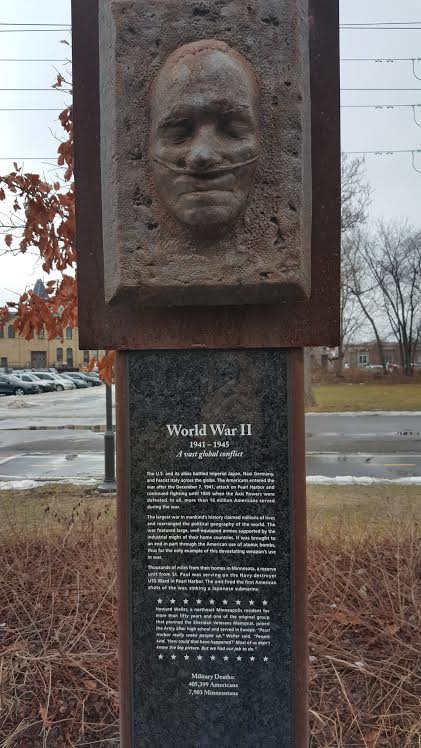
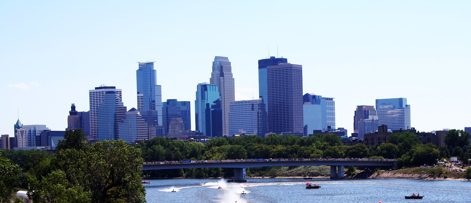
Photo by Michael Hicks 

We tend to think of bridges as utilitarian objects, when we think of them at all. A transit point between two parts of a city. An inconvenience to be gotten past.

Stopping on a bridge is probably last on most people’s minds, since generally it would mean one is stuck in traffic, a major inconvenience.

I’m here to suggest you park your vehicle, get out, walk and look. Slow down. For this is a great time of year to do so.

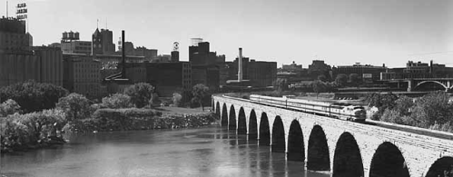
Stopping along any of the three bridges will give you some of the best views of the Minneapolis skyline. We’re heading into fall, and the river is incredible with fall colors. Every day you can be surprised and awed about how beautiful the river is, whether we’re talking about the Plymouth Ave. Bridge or Broadway or Lowry.

It’s very easy to make an afternoon of it. You could drive between the bridges, but instead, you should think about biking. Or even walking. From the Plymouth Ave. Bridge, it’s only three-quarters of a mile to walk to Broadway and a total of two miles to Lowry. That’s easily manageable by foot, although there are Nice Ride stations where you can easily rent a bike all through this area.

There are, of course, things that are common to the view to all three of these bridges. Plymouth is your closest view to downtown. That’s where the skyline and entrance, the flow of the river into downtown is more apparent. You have Boom Island Park right there for a green setting. It’s also the most bike-friendly of the three bridges.

If you want to get out and walk, or park and bike, you can park along the river roads, especially along West River Road. There is also a paid lot here at Boom Island.

On the Broadway Avenue Bridge, you get a sense of the expanse of the river, both to the south and the north. You’re in the center of the upper river area, with downtown on one side and industry on the other.

Parking is similar, again, especially along West River Road. On the Northeast side, there is street parking along 13th Avenue NE, as well as parking for Sheridan Memorial Park.

The Lowry Avenue Bridge is the newest of the three and it’s the only one with lighting in this corridor. Now there is talk about lighting even more bridges. The thing about the Lowry bridge is it’s the best place to get a view of the Upper Harbor Terminal. It’s also by the Mississippi Watershed Management Organization building, and there’s a path down to the shore.

From Lowry you can get a sense of all the river activity, including the docks by The Sample Room, the houseboats along the river. You realize that people use the river in lot of ways that one never thinks about. You just get a sense that there’s this river community when you are looking at it from the Lowry Bridge toward the south, from the northeast side.

There is parking along Marshall Avenue in this area.

Of course, there is one more bridge even further up, and from the Camden Bridge you get a completely different sense of the river and of downtown. Think of it as the entrance to Minneapolis. This will also be the place to watch the UHT work once it gets underway.

These crossings serve to do more than help get us from Point A to Point B. They’re a beautiful vantage point above the Minneapolis riverfront which can give us a new perspective.

Kathleen Boe is Executive Director of the Minneapolis Riverfront Partnership. She can be reached at kathleen.boe@minneapolisriverfront.org.

Monday
Aug072017

Exploring the Upper River: Paddle Share

Article by Kathleen Boe, Minneapolis Riverfront Partnership

Exploring the Upper River

 A look at hidden gems along the Minneapolis Riverfront

This monthly series has been about areas along the river – places to visit alongside the Mississippi River in Minneapolis. But it’s also possible to take that one step further.

People ask, can I swim in the Mississippi River, can I fish in it, can I touch it with my toe. And the reality is, yes, you can fish. You can swim in the mighty Mississippi – given, of course, the appropriate level of care and caution. 

But there’s another easy way to get on the river as well, and that’s with the Mississippi River Paddle Share program.  

This is one of the new cool things you can do on the river: renting a kayak. It was originated by the National Park Service and it’s overseen by the Mississippi Parks Connection. It’s everyone’s opportunity to get out on the river.

Photo: the National Park Service

There are two options now, and there’s a third on the way.

You can start at North Mississippi Regional Park, at the north end of the Minneapolis riverfront and rent a single-person or two-person kayak for a three-hour span. The return station is at Boom Island Park, just under four miles down the river. The paddling itself should take around half that time, so there is plenty of time to relax and observe.

The other option is to start at the Lowry Avenue Bridge, at the Mississippi Watershed Management Organization building, and paddle a little less than two miles down to Boom Island. This station has only single-person kayaks, but the price is a little lower. It’s under an hour to get to Boom Island, so there’s plenty of time to actually go upstream a little bit and see the heron rookery before heading downstream.

Each rental location has everything you need – the kayak, a life jacket for each person and a paddle. You reserve your kayak online at paddleshare.org.

If you don’t have your own kayak and you want to get out on the river, this is a cool way to do that. Soon there will be a third option as well, to start at Hidden Falls Regional Park and continue down to Harriet Island in St. Paul.

The history of our river is really about the pathway, where the river was the centerpiece around how you would get somewhere. You would start by going along the river, then fan out from there.

Over time we’ve changed that. Instead, we approach the river from our neighborhoods and now perhaps we see the river as a border we can’t go across.

One of the things that’s great about this program is that it’s an opportunity to get people actually on the river. This is your chance to be in it.

This area is pretty neat because the water isn’t very deep. Depending on the day, it’s a nice current as well. If you’re going from point A to point B, you are going downstream the whole way.

With the lock closed, there’s no commercial traffic on this part of the river, either. It’s a very peaceful way to see the Mississippi. You see the river and the shoreline from an entirely different viewpoint. You can see into people’s yards and into the industrial area. There’s something about the character of the river up here that’s unique in its own way and you get that sense when you’re on the river, in a kayak.

Photo: the National Park Service

Given the leisurely time frames – a three-hour rental for a ride that takes less than half that – you have plenty of time to stop somewhere along the way. Or, after you take the kayak out at Boom Island, hop on a Nice Ride bike and stop somewhere on the way back to your car. There are many options, not the least of which would be the Northeast Yacht Club, 1029 Bar, Elsie’s or The Draft Horse.

Kathleen Boe is Executive Director of the Minneapolis Riverfront Partnership. She can be reached at kathleen.boe@minneapolisriverfront.org via email, or online at minneapolisriverfront.org.

Monday
May222017

Exploring the Upper River – Edgewater Park

Article by Kathleen BoeMinneapolis Riverfront Partnership

Exploring the Upper River

A look at hidden gems along the Minneapolis Riverfront

Through the course of this series on placemaking, we’re visiting parks, areas of green space and locations of interest along the upper river and the Minneapolis Riverfront.

But as you’re driving along Marshall St. NE, you might miss this spot. It’s at a busy intersection of Marshall and Lowry, where we’ve already written about Stormwater Park and there’s even more to discover than can be covered in this piece. So you might be forgiven if Edgewater Park has receded into the background for you so far.

I’m here to change that.

Edgewater Park sits on the southwest corner of Marshall and Lowry. The park is, of course, at the edge of the water, but the name also comes from the Edgewater Inn, which was a popular music spot on the site. The city acquired the land in 1993 and Edgewater Park was built as part of the Above the Falls Master Plan in 2006 thanks in part to funding from the Mississippi Watershed Management Organization. The park was dedicated in the spring of 2007.

This space was envisioned as parkland as far back as 1883, among Horace Cleveland’s initial suggestions to the city of Minneapolis, but it was not originally developed as such.

The park itself features a small picnic area and a walking path, but you might easily miss its key feature if you’re not aware of it coming in. The layout of Edgewater Park mimics the flow of the Mississippi and Minnesota Rivers through the area, with the Mississippi (pictured) heading out of the park toward Lowry and the Minnesota headed out toward Marshall. An aerial viewwill give you the best perspective.

While you’re there, also take note of how the park is divided into two distinct pieces, with planting and grasses distinguishing the metro area from the prairie.

At the midpoint of the park, near the confluence, as it were, of the two paths, is a lookout, mimicking the view Fort Snelling has on the actual rivers themselves.

This lookout is a great spot, too, to observe what is going on across the river. In two years we’ll have Northern Metals shutting down and starting to head out, removing some of the heavy industrial work. So when you visit, take a few minutes to envision what a mixture of parkland, trails and housing or light industrial use might look like on the river’s west bank.

So, the next time you’re taking a Nice Ride bike along the East Bank trail, continue up Marshall for a few more blocks and check out Edgewater Park. Drop off your bike and head into Tony Jaros Rivergarden for a greenie, or check in at Betty Danger’s. It’s a good time of year to hit the Ferris Wheel.

Kathleen Boe is Executive Director of the Minneapolis Riverfront Partnership. She can be reached at kathleen.boe@minneapolisriverfront.org via email, or minneapolisriverfront.org on the web.

Monday
Apr242017

Exploring the Upper River – Mississippi Mushrooms

Article by Kathleen BoeMinneapolis Riverfront Partnership

There has been a tremendous amount of discussion about the revitalization of the Upper Harbor Terminal area, and the attention is deserved. But there are already businesses at work in that area, bringing new life to the former industrial center.

One site worth visiting is Mississippi Mushrooms. This is a certified organic mushroom farm located in the Upper Harbor Terminal alongside the river in North Minneapolis at 3800 First Street North.

The farm is run by Ian Silver-Ramp, a 2010 University of Minnesota graduate who is applying his degree in Applied Plant Science in creating an ecologically friendly growing process. He began the business five years ago, moving to the Upper Harbor Terminal site a year and a half back.

Mississippi Mushrooms is really a grounds-up operations, literally. The growth process for these specific mushrooms, Grey Oyster, King Oyster, Nameko, and Pink Oyster varieties, involves taking the discards from other businesses to make the base material. These are wood-eating mushrooms, and the base material includes scrap lumber, locally sourced and turned into sawdust, as well as the spent grain from a local brewery. That base material gets sterilized and is then injected with fungus, allowing it to grow and blossom into a mushroom.

After the mushrooms are harvested, the base material is turned into compost, and that is something which can be sold to plant stores and other outlets. The compost smelled just like spring and made me want to go home and start spring planting.

But a mushroom farm of this type doesn’t really resemble a farm as you and I would know it, or even your garden, window box or greenhouse. The facility is indoors, of course, with rooms walled off for each growing stage. Each of those stages requires different levels of light, humidity and temperature, as well as carbon dioxide levels. And Silver-Ramp can monitor all of that from his mobile device.

The climate controlled operation also means mushrooms can be grown and sold fresh, year-round.

The farm is in a part of North Minneapolis which is still dominated by heavy industrial work, so during the week, the area is teeming with construction vehicles. However, Mississippi Mushrooms is only open to the public on Saturdays and Sundays from 11-2, and on those days, the roads are much more quiet. To get to the site, drive onto the property from Dowling, stay to the right of the domes and drive back to the big warehouse. Look for the Mississippi Mushrooms sign on the door, on the side of the warehouse which faces the river.

This is a great opportunity to see a farming operation in the city, while also see a little bit of the Upper Harbor Terminal site. It’s also a chance to get a sense of what could become of this mile of the Minneapolis riverfront, with a great view of downtown.

If you’re looking for a place to eat to pair with this visit, of course, you can check out one of the many fine restaurants that locally source their mushrooms from Mississippi Mushrooms. But for a choice that’s a little closer by, check out Serendripity Spot, which is at 33rd and Lyndale Ave. No. It’s open six days a week (close on Fridays) and was recently rated as having the Top Waffle in the Twin Cities. But in addition to waffles and coffee, Serendripity is committed to eliminating waste, with no landfill waste or even recycling. (If you want coffee to go, bring your own reusable travel mug, or buy one on site.)

Kathleen Boe is Executive Director of the Minneapolis Riverfront Partnership. She can be reached at kathleen.boe@minneapolisriverfront.org via email, or minneapolisriverfront.org on the web.

Saturday
Mar252017

Exploring the Upper River: LifeSource

Article by Kathleen Boe, Minneapolis Riverfront Partnership

Exploring the Upper River

A look at hidden gems along the Minneapolis Riverfront

LifeSource is an organization with a special mission and a special place in the hearts and minds of many people.

The organization manages organ, eye and tissue donation across the Upper Midwest, serving Minnesota, the Dakotas and areas of western Wisconsin. They work with hospitals and with the community to support the families of donors and encourage donor registration.

LifeSource also occupies a pretty special place along the Mississippi River in North Minneapolis. It’s at the end of the road, for now, along the west side of the river – driving along West River Road, the parkway and the bike trail come to an end right outside.

The organization moved here from St. Paul and broke ground on a sparkling new campus along the river in 2013. They were very taken by the view, and the sense of calm, and how that tied into the mission of helping both families who have lost loved ones and those who have benefited from organ donation.

The interior was designed with the families’ experience in mind. But on the outside, they took this to another level. The campus includes a memorial garden, which contains a wall remembering those who donated organs, eyes or tissue, as well as garden benches which serve to help memorialize donors as well.

And here’s where the site comes into play, because I’m really struck by the river in that area. It’s a wonderful view of the river because you can see south to the Broadway Avenue Bridge and the Plymouth Avenue Bridge and downtown. We often think of making connections with the river from downtown, but there’s a sense of magnificence when you see the river from this area. You get a bigger impression of the river’s role in the city.

Orvin “Ole” Olson ParkThe LifeSource Healing Garden offers people a chance to take a pause and take in what this river is. It’s wide, it’s powerful, and it’s a view of what the river should be: banked by parkland on both sides. Orvin “Ole” Olson Park sits between LifeSource and the river, ensuring that a clear view will be enjoyed by all for years to come.

Broadway Pizza, of course, is right nearby. But with further exploring, take another drive down Broadway to visit Breaking Bread Café or pick up a cookie at Cookie Cart. These are both locations that not only serve great food, but serve as job creation and job training centers, helping young people get the skills they need to be successful in the work force.

Kathleen Boe is Executive Director of the Minneapolis Riverfront Partnership. She can be reached at kathleen.boe@minneapolisriverfront.org, or through minneapolisriverfront.org.

Saturday
Feb252017

Exploring the Upper River: Stormwater Park

Article by Kathleen BoeMinneapolis Riverfront Partnership

Exploring the Upper River

A look at hidden gems along the Minneapolis Riverfront

As you come across the Lowry Bridge into Northeast, or drive north on Marshall, it’s easy to get caught up in looking at the bridge itself, especially if it’s lit up at night, or the Ferris Wheel outside Betty Danger’s Country Club. But the hidden gem I’m writing about this month would be right under your nose at that point, Stormwater Park at the Mississippi Watershed Management Organization’s facility, 2522 Marshall Street NE.

The Minneapolis Riverfront Partnership has had the privilege of having an office in this building over the past five years, and during that time, the building and the space around it have really come into their own.

One of the areas that is open and accessible to the public is the Stormwater Park itself. The area, off the Marshall street front, heads down behind the MWMO building and slopes down to the river. While this area is a park, it is also an active demonstration project using the many tools that MWMO recommends to ensure that stormwater run-off is as clean as it can possibly be when it reaches the river.

To start, if you can take your eyes away from the river, look down. You’ll see permeable pavers that allow water to be absorbed, rather than run off.

Continuing on, a wildflower garden borders the building and serves as a filtering system for stormwater coming off the street. In the spring, it blooms into the most incredible set of flowers. Under the flowers, the garden acts as a filtering system. The goal is for all of the stormwater to be captured and filtered on site.

This is one of the places where you can actually dip your toes in the river – in season, mind you. It’s not recommended after the recent return of cold weather. But there is a meandering path down to the water, with markers noting the high-water mark of various Mississippi River flood events in recent history. 

At river’s edge, there is a beach, and it’s not uncommon to see people launch canoes or kayaks from that spot. The Mississippi Parks Connection’s kayak sharing program placed one of its locations at MWMO and that’s a legitimate option for getting on the river this summer.

This is an area where every day the river looks different, depending on how cold it is, what the wind is like, the angle of the sun. As the sun sets, the Lowry Bridge will light up in the color scheme scheduled for that night.

While visiting, you can always stop by and have a Greenie at the historic Tony Jaros Rivergarden at the corner of Lowry and Marshall, or grab a tea at Betty Danger’s across the street. The Ferris Wheel has occasionally been in operation this winter, and commands a great view.

Meanwhile, it’s been a privilege to be part of this community at MWMO. While the first thing one notices is the light-filled space and unique design of this building, as you work here you also appreciate the community and staff who work here, how passionate they are about their mission, and how they care so deeply about the watershed that feeds the Mississippi River.

Kathleen Boe is Executive Director of the Minneapolis Riverfront Partnership. She can be reached at kathleen.boe@minneapolisriverfront.org via email, or minneapolisriverfront.org on the web.

Friday
Jan272017

Exploring the Upper River: Sheridan Memorial Park

Article by Kathleen BoeMinneapolis Riverfront Partnership

Exploring the Upper River

A look at places that are hidden gems along the Minneapolis Riverfront

At the end of 13th Street NE in Minneapolis is one of the city’s hidden gems: Sheridan Memorial Park.

Head west, down 13th Street, past the old Grain Belt brewery and you find yourself in Sheridan Memorial Park. One of the newest parks in the city of Minneapolis, the park was dedicated just over two years ago. It is an important place, not just for Northeast Minneapolis or the city as a whole, but the entire state.

Sheridan Memorial Park is dominated visually by the orange globe in the center. The real significance is that it serves as a veterans memorial park for the entire state of Minnesota – recognizing those who served in 10 conflicts the U.S. has been involved with since statehood – starting with the Civil War.

The Sheridan Neighborhood Association worked with World War II veterans to get this accomplished. The veterans’ stories can literally be found all around the memorial. Pillars around the perimeter of the memorial give a brief synopsis of each conflict, along with a veteran’s personal story. The pillars also record the number of Minnesotans killed in each conflict, from seven in the Persian Gulf War to 104 Minnesota soldiers and militia and 30-50 Dakota warriors in the U.S.-Dakota War of 1862 to 7,903 in World War II.

Each also prominently features a bronze casting of the face of a veteran of the conflict. The Civil War pillar cites Patrick Henry Taylor, who was a sergeant in the First Minnesota Regiment. His brother, Isaac, was killed in the Battle of Gettysburg. “Isaac has not fallen in vain. He died for a noble cause. As we laid him down, I remarked, ‘Well, Isaac, all I can give you is a soldier’s grave.’ I then sat down on a stone while two comrades buried him.”

The most touching pillar is from World War II, featuring a casting of the face of Howard Weller, who was the last surviving member of a group of more than a dozen people, headed by Ed Karbo, Sr., who got the ball rolling on a veterans memorial. Weller, who lived in northeast Minneapolis for more than 50 years, is depicted with oxygen tubes to help him breathe.

Although the memorial is in place, the park itself is still a work in progress.  The Minneapolis Park Board plans to expand this park as part of the continued expansion of parkland along the east bank of the Mississippi River. The Park Board was awarded a federal grant of $500,000 to help fund improvements in the form of a picnic shelter, restrooms and a playground at Sheridan Memorial Park.

The park is accessible not just by car, but by foot or bicycle along the new East Bank Trail. It’s a reasonable walk from Boom Island, along the river through the former Scherer site and past Graco. From the overlook on the edge of the park you can see the river and see across the river to where more green space sits, in front of Broadway Pizza, the Minneapolis Park and Recreation Board and the Lifesource building. Parkland is expanding to the northern reaches of the City.

While you’re there, warm up with a drink at SiP Coffeebar, or if you’re craving something different, try Bunny’s Bar and Grill. You won’t regret it.

I'll be back each month to talk about some other unsung spaces along the Upper River.

Kathleen Boe is Executive Director of the Minneapolis Riverfront Partnership. She can be reached at kathleen.boe@minneapolisriverfront.org via email, or minneapolisriverfront.org on the web.